Features Brief
Veeva Territory Designer Features Brief
Insights into field engagement with HCPs who see your ads.
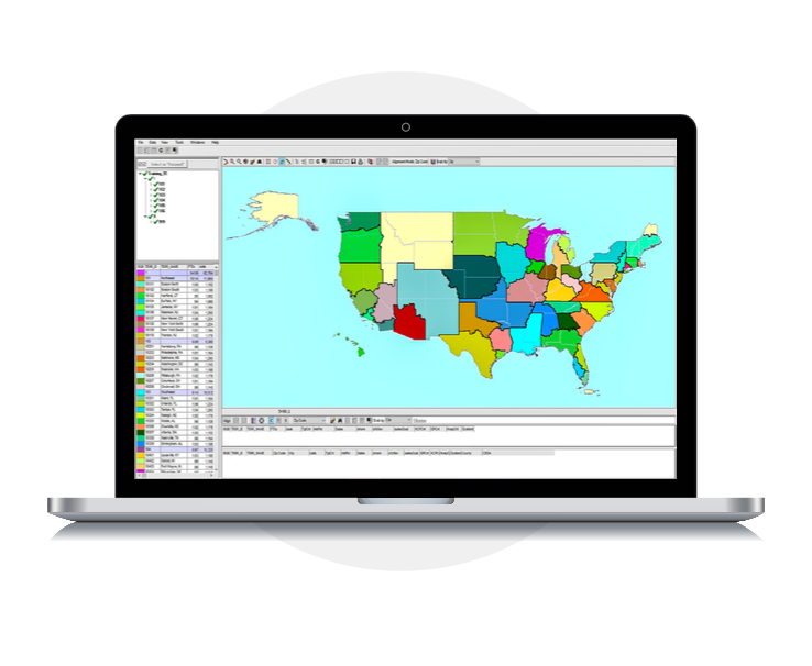
Veeva Territory Designer (formerly Veeva Align+) streamlines the territory design process, enabling you to move from initial territory creation to field execution faster than ever before. Its comprehensive visualization tools allow you to view multiple data sets simultaneously and geographically, providing a deeper understanding of your territories. And because Territory Designer seamlessly integrates with Veeva Vault CRM Align and Veeva Vault CRM, you can avoid unnecessary costs, manual uploads, and wasted time.
Business Benefits
-
Deeper insights.
Understand your territories better and gain new insights with robust visualization tools that support the field planning process.
-
Optimized field design.
Discover your ideal territory scenario through rapid iteration and testing. View the impact of territory changes instantly.
-
Faster execution.
Speed the process from field strategy to execution with prebuilt Veeva connectors. A simple export procedure prevents data errors and reduces manual handoffs.
Just install—no implementation needed.
Features
Veeva Territory Designer expedites territory design and provides flexibility for on-demand response to market updates and evolving HCP preferences.
-
Integrated with Vault CRM Align and Vault CRM
Reduce data errors and delayed field execution with automatic importing of geographic and hierarchy information from Align. Leverage field feedback in real time with a direct connection to Vault CRM.
-
Optimizer tool
Find the best territory design for your field teams with automatically generated territories optimized by any metric at the click of a button.
-
Attributes and affiliations
Visualize broad and detailed views of crucial information to distribute your field forces more effectively. Simplify data driven territory adjustments with real-time queries.
-
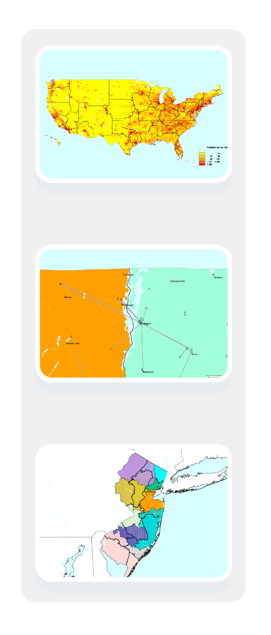
Layers
Access all your information in manageable amounts. Design territories your field teams can execute with a view of geographic features, roads, and borders. See attributes like annual call frequency and script data for a more accurate view of business impact.
-
Visualization tools
Improve field design and discover new insights about your territories by comparing heatmaps and adjusting territory boundaries in real time.
-
Data options
Leverage a variety of data to drive your best field design. Import account information from any desired data source, including Veeva OpenData, Veeva Link, and Veeva Compass, and view multiple data sets at once.
Learn more about how Veeva Territory Designer can help improve your territory design process.